The United States is preparing for snow and strong precipitation as a significant storm is expected over the upcoming weekend.
Meteorologists caution that a weather system may bring heavy rains and potential tornadoes to the southern United States next week, as cities nationwide prepare for severe weather in the days leading up to the weekend.
According to the Weather Channel, a potent storm system is forecasted to bring strong winds and heavy rain to the Gulf coast and southeastern areas starting on Monday and lasting through Tuesday.
Sections of Louisiana, Mississippi, and Alabama may also be susceptible to flooding due to intense thunderstorms, with potential rainfall amounts of up to 5 inches in certain locations.
Recent severe weather is expected to coincide with a significant storm that will likely result in heavy snowfall in northern states and intense rain along the Gulf coast.
Weather experts are cautioning that the storm may bring significant amounts of snow to the north-eastern and New England regions, where certain cities have not experienced significant snowfall in recent years.
The National Weather Service Boston has reported that Maine, Rhode Island, and Connecticut may experience 6-12 inches of snow.
The Boston Globe reported that a winter storm watch is currently in place for certain areas of New Hampshire. The expected storm has the potential to bring 6 inches of snow. Additionally, over 25 million individuals across the eastern coast of the United States, from the Carolinas to Maine, are under storm watches.
The eastern cities on the coast are likely to experience more rain than snow. New York City is predicted to get less than one inch of snow, following a winter with no snow last year.
According to local news station Fox 5, it had been 690 days since New York City received at least one inch of snow, setting a new record. The effects of the climate crisis, such as global warming, are resulting in warmer and wetter winters in various regions.
According to CNN, the Hudson Valley region of New York may experience 2-4 inches of snow over the upcoming weekend.
There is a possibility of light snow in Washington DC, Baltimore, and Philadelphia, but the majority of heavy snowfall will occur further inland along the eastern seaboard.
AccuWeather reported that the Gulf coast states, including Georgia and Mississippi, were anticipated to experience significant precipitation and thunderstorms beginning on Friday and continuing through the weekend.
Severe weather conditions caused a tornado alert for certain areas in south-eastern Texas on Friday morning, but it concluded at 6:15am central time, according to the National Weather Service.
According to ABC News, a large storm that has spread across the country has already impacted areas such as New Mexico and portions of Texas.
after newsletter promotion
On Thursday, the mountainous region near Santa Fe, New Mexico experienced a snowfall of 10 inches as the storm moved further north.
Residents of Amarillo, Texas, the largest city in Texas’s panhandle region, received 1-3in. Northern parts of the Texas panhandle faced upwards of 5in of snow.
At the moment, cities along the western coast of the United States are preparing for another instance of powerful waves this weekend. It is predicted that waves as high as 26ft will hit northern California and southern Oregon, while areas further south, such as San Francisco and San Diego, may experience waves up to 10ft.
Large swells have been crashing onto shorelines since the beginning of the year, bringing joy to surfers but also posing dangers such as sweeping away vehicles, causing water rescues, and overflowing onto structures like jetties and rocks. The NWS has cautioned that the upcoming round of powerful waves could result in beach erosion, destruction of infrastructure, and potential injuries.
According to the National Weather Service, a chilly front originating from the Gulf of Alaska will result in a widespread occurrence of rain in the valleys and snow in the mountains in northern California. The forecast was issued on Thursday. The storm is predicted to move southward along the west coast, bringing snow to peaks along the Cascades and some areas of the northern Rockies. The Sierra Nevada mountain range, which has experienced unusually low levels of snow this season, may receive up to 2ft of snow at elevations above 5,000ft.
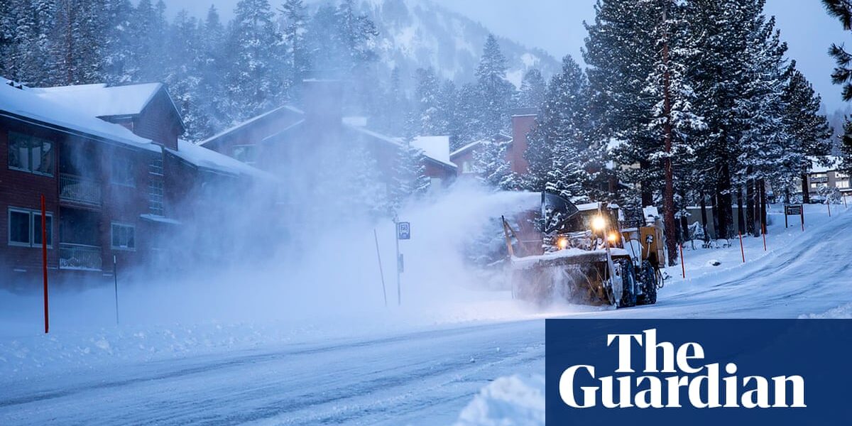
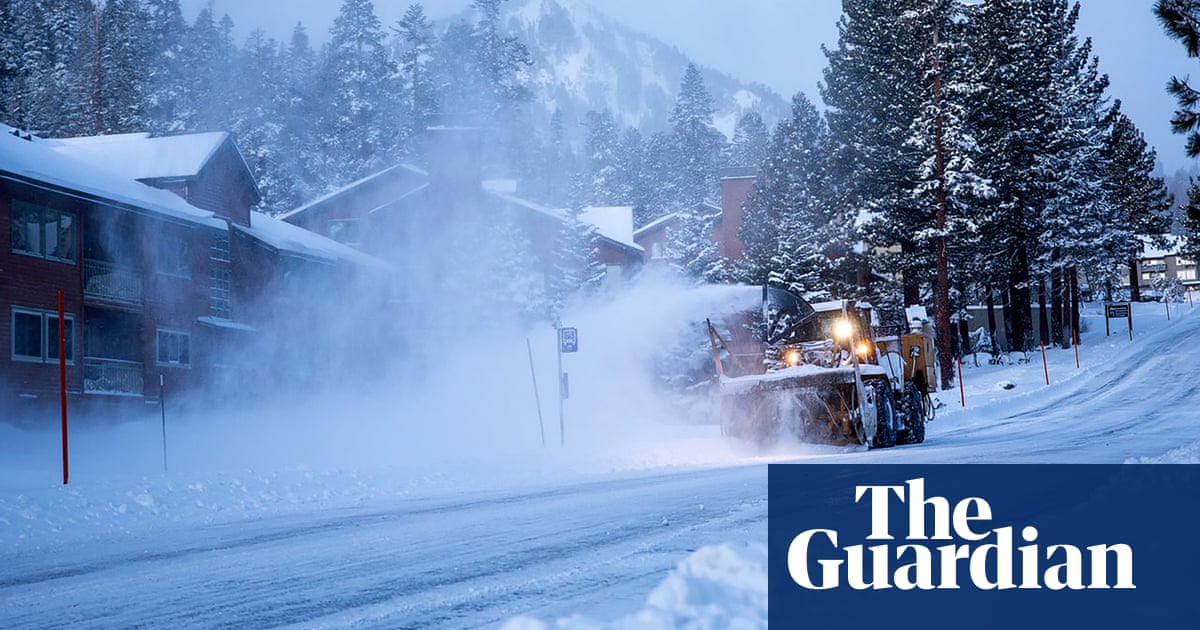
A storm is expected to bring heavy snow and strong winds to the Lake Tahoe area. Elevations above 7,000ft could see up to 20 inches of snow, while winds of up to 100mph are possible in higher elevations. Lower elevations may experience gusts of up to 50mph, and waves in Lake Tahoe could reach 4ft. Officials cautioned that travel in the area may be extremely challenging due to whiteout conditions, and the strong winds could cause damage to trees and power lines, potentially leading to power outages.
While the storm has the potential to cause harm, it is appreciated by water managers in California who rely on snow for their water supply. This year’s winter has been warmer compared to last year, when multiple intense storms brought heavy snowfall to mountain communities and filled the state’s reservoirs.
On the other hand, the state is preparing for the possibility of a “snow drought” this year and meteorologists are optimistic that additional cold snowstorms will occur before spring. The overall snow levels in the state were only at 25% of the usual amount, according to the January survey released on Tuesday prior to these recent storms.
Source: theguardian.com